The Land
Almost all of Bangladesh consists of a flat, low-lying alluvial plain formed by soil deposits from rivers. The country lies less than 50 feet or 15 meters above sea level. A small part of the country in the northeast and southeast have many rolling hills.

Among the hills are Tea farms like this which provide tea to various countries.

Mount Keokradong is the highest peak in Bangladesh, at a height 4,034 feet.
Rivers and Streams
In Bangladesh there are three major rivers. They are the Ganges ( also called Padma ), The Brahmaputra ( also called Jamuna ), and the Meghna. The names of these rivers tend to change as they intersect and cross borders. Much like in Egypt the river systems and their branches overflow during the rainy season causing the soil to become rich. Rice and several types of juices are produces at the flood deltas, and are one of the biggest exports in Bangladesh.
Bangladesh Coastline
The coastline of Bangladesh is a 357 mile stretch along the Bay of Bengal. This coast includes inlets, island, and deltas. The coast is constantly being reshaped by floods, tidal waves, and new river flow.
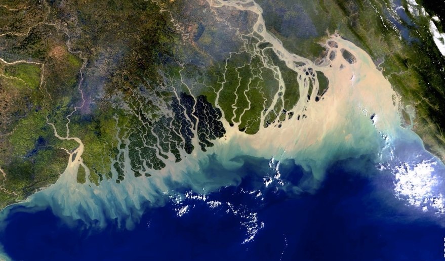
As you can see, there are many areas where rivers empty into rich deltas. These deltas sometimes erode changing the coast of the country constantly.
Forests of Bangladesh

Bangladesh has large bamboo forests in the Chittagong Hills. These forests provide wood and refuge for native species like the Bengal Tiger. In these forests and their surrounding areas it is not uncommon to find Mango trees, and Palms trees amid the Bamboo.
Tropical Mangroves and other tropical plants live in a area called the Sundarbans. These regions are swampy and very hard to live in.
Tropical Mangroves and other tropical plants live in a area called the Sundarbans. These regions are swampy and very hard to live in.
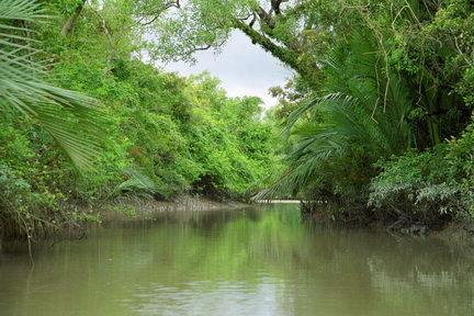
A river winds through a Sundarban
